- April 11, 2025
-
-
Loading

Loading

Longboat Key beach enthusiasts have for years had the run of the town’s nearly 11 miles of Gulf of Mexico shoreline, which up until this summer included a 209-foot stretch of privately owned seawall on one of the town’s most iconic properties.
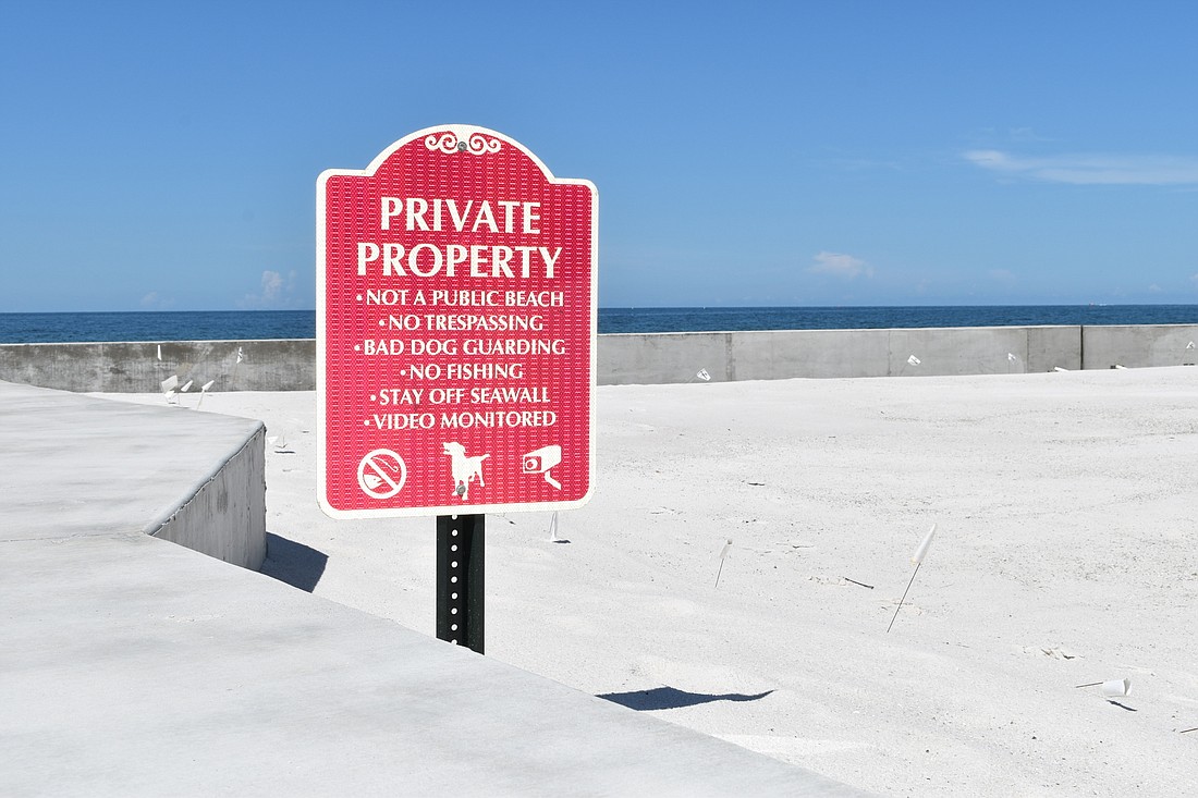
But a few weeks ago, following repairs to the seawall following Hurricane Eta in 2020, the owners of the property known as Ohana at 6633 Gulf of Mexico Drive, posted signs that their property, which extends to the water's edge, was now off limits.
The only way to avoid trespassing on Ohana Hale Estate Land Trust property is now to wade into the surf, which often breaks right on the seawall, or make a 1-mile detour along Gulf of Mexico Drive using the two nearest public beach-access spots.
The seawall that extends all the way to the state’s erosion control line is unusual and dates back more than 50 years, town attorney Maggie Mooney said.
“All of a sudden, we see signs saying that they had an invisible fence and a dog in training, and that’s where we all went, ‘Oh, OK. Things are changing,’” Longboat Key Turtle Watch Vice President Cyndi Seamon said of volunteers who scour the beach regularly during nesting season.
Mooney explained the public’s right to access the beach area seawards of the state-drawn erosion control line (ECL).
“Those same general laws provide that property landward of the ECL is generally considered private property,” Mooney wrote in an email. “My understanding is the seawall runs along the ECL line, which is the basis for the property owners’ claim and assertion of control over the entire area landward of the seawall.”
Beyond the assertion that passage is prohibited, posted signs make reference to a guard dog. One that bites.
“It impacts a lot of people that live in Sleepy Lagoon, everybody who is along the beach,” Seamon said. “It impacts a lot of residents.”
A representatitive of the Ohana Trust did not wish to be interviewed for this story but released a statement via email from an account bearing the name “Michele Ohana.”
“We have been in frequent dialog with the town of Longboat Key in reference to public safety concerns and actual incidents involving injuries at the seawall as it relates to liability imposed on the Trust,” the email said. “During these communications we have proposed multiple notions including indemnification by the Town of public injury, a safety guard rail, concrete barriers, renourishment of sand seaward of the seawall to provide pedestrian access behind the wall, as well as groins that would hold in that sand permanently.”
The trust also indicated the owners have also offered to dedicate owned property for a public boardwalk “seaward of our wall.” The trust said the town has not accepted any of the options it presented.
Longboat Key’s Planning, Zoning and Building Department, approved a permit in December 2020 for Ohana’s seawall reconstruction following storm damage during Eta in November. The work was valued at $132,000.
Public Works Director Isaac Brownman said Ohana’s proposals aren’t practical.
On two occasions, during beach renourishment projects in 1994 and 2005-06, the town dumped extra sand north and south of the Ohana property in hopes of creating a dry strip between the seawall and the tide. The over-placement of sand lasted only a few years before it washed away.
In 2019, the Ohana property sold for $11.4 million. Kathryn Hutcheson sold the property to “Elliott, Robinson & Company, LLP, a Missouri limited liability partnership, as Trustee of the Ohana Hale Estate Land Trust.”
For people to walk around the Ohana property, Longboat Key offers beach access points at 6847 Gulf of Mexico Drive to the north and 6399 Gulfside Road near General Harris Street to the south. The two beach accesses are about a mile apart.
Seamon said she is hopeful the Ohana property owners and the town can reach some sort of compromise.
“It would be great to have that access that we used to have,” Seamon said.
Mooney said the town is looking into the history of the property and the seawall’s permitting, previous public access and potential customary uses to determine whether there is a public right of access across some portion of the property.
“It is also my understanding that the seawall and the unique beach frontage conditions at this site have been there for over 50+ years,” Mooney wrote.