- November 5, 2025
-
-
Loading

Loading
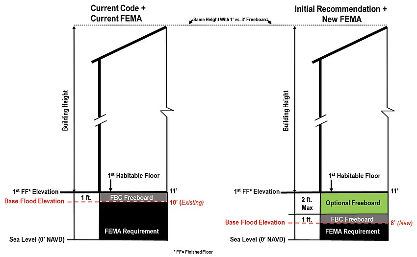
At the April 1 regular meeting, Longboat Key town commissioners voted to pass an ordinance allowing for property owners to include up to 3 feet of freeboard — two optional feet on top of the required 1 foot.
An option to allow two more feet of freeboard — 4 feet total — was also on the table, but commissioners needed more research and development for that ordinance.
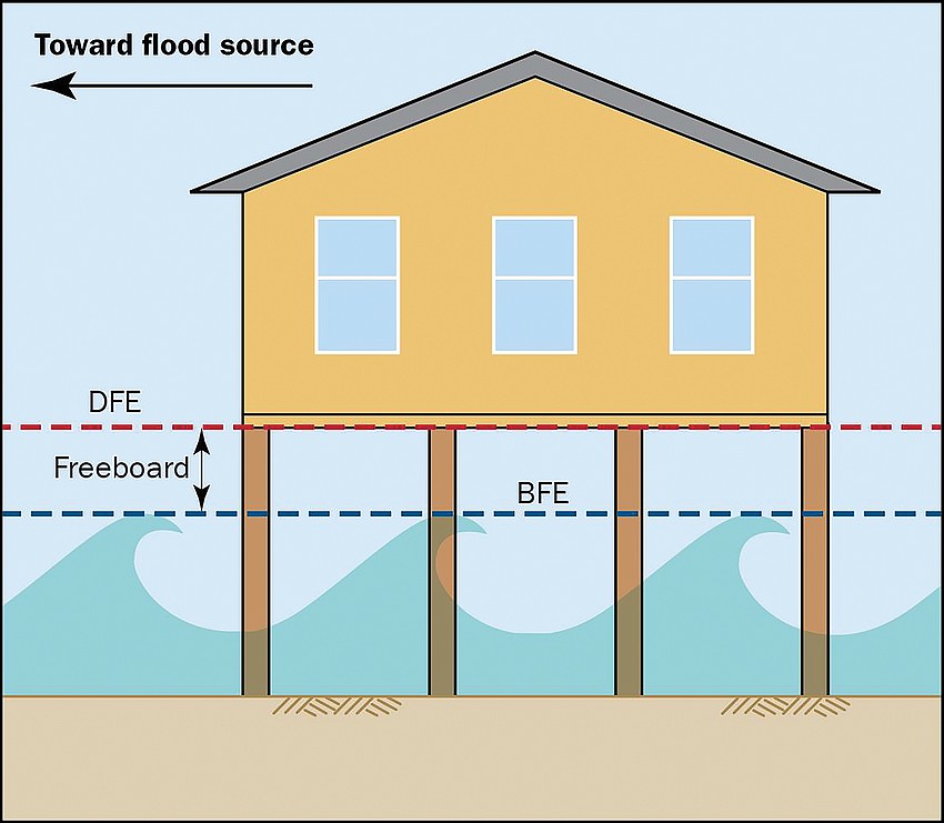
Base flood elevation (BFE) is the estimated level of surface water expected during a 100-year base flood event. Freeboard is a safety feature of floodplain management and is added on top of the BFE height to equal a property’s design flood elevation.

In January, Planning, Zoning, & Building Director Allen Parsons presented the new flood control maps for Sarasota County as prepared by the Federal Emergency Management Agency. Those maps generally had a decrease of 2 feet of base flood elevation recommendations across the town.
FEMA regularly updates the maps, and Manatee County received its own set of updates in 2021. Those maps showed a similar decrease, according to Parsons.
The Florida Building Code and the town’s code have a freeboard requirement of 1 foot, but Parsons said the Planning and Zoning Board put forth this ordinance to maintain the status quo after the new FEMA maps.

At a Town Commission meeting on March 4, Parsons presented both the 2-foot and the 4-foot options, and said that the Planning and Zoning Board recommended the optional 4 feet to do more for property owners.
After discussion at that meeting, commissioners voted to move forward with the 2-foot option and direct staff to begin exploring the additional 2 feet in select areas of the town.
Parsons brought back a little more information to the second hearing on April 1, including sea level rise prediction graphics prepared by Aptim.
Those maps were more confusing than clarifying for commissioners, though, and Commissioner-At-Large BJ Bishop questioned the validity of the maps after seeing her own house was marked as one of the properties with higher elevation.
“I have no faith in where this map came from, but it’s not correct,” Bishop said.
But the ordinance-at-hand was to allow for the 2 feet of optional freeboard and direct staff to further explore the 4 feet option, possibly limiting it to low-lying areas.
That comes with another caveat — defining “low-lying.”
Low-lying properties would most likely be those with an elevation less than or equal to 3.5 feet above sea level. There was also discussion as to how that would be measured, either an average of the whole property or just at street level.
Bishop urged that if staff hold on the 4-foot option it be explored quickly before the commission enters summer recess.
Realistically, Parsons said the ordinance would go back to the Planning and Zoning Board in May. There are two voting meetings in June before the commission’s summer recess, which is enough for two public hearings.
Commissioners voted unanimously to approve the ordinance allowing for an additional 2 feet now and directed staff toward the 4-foot option.